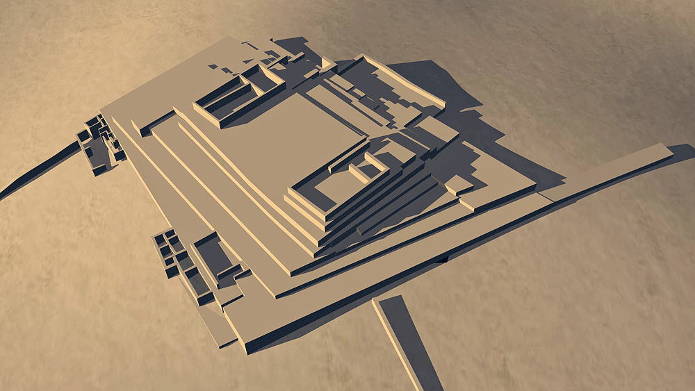
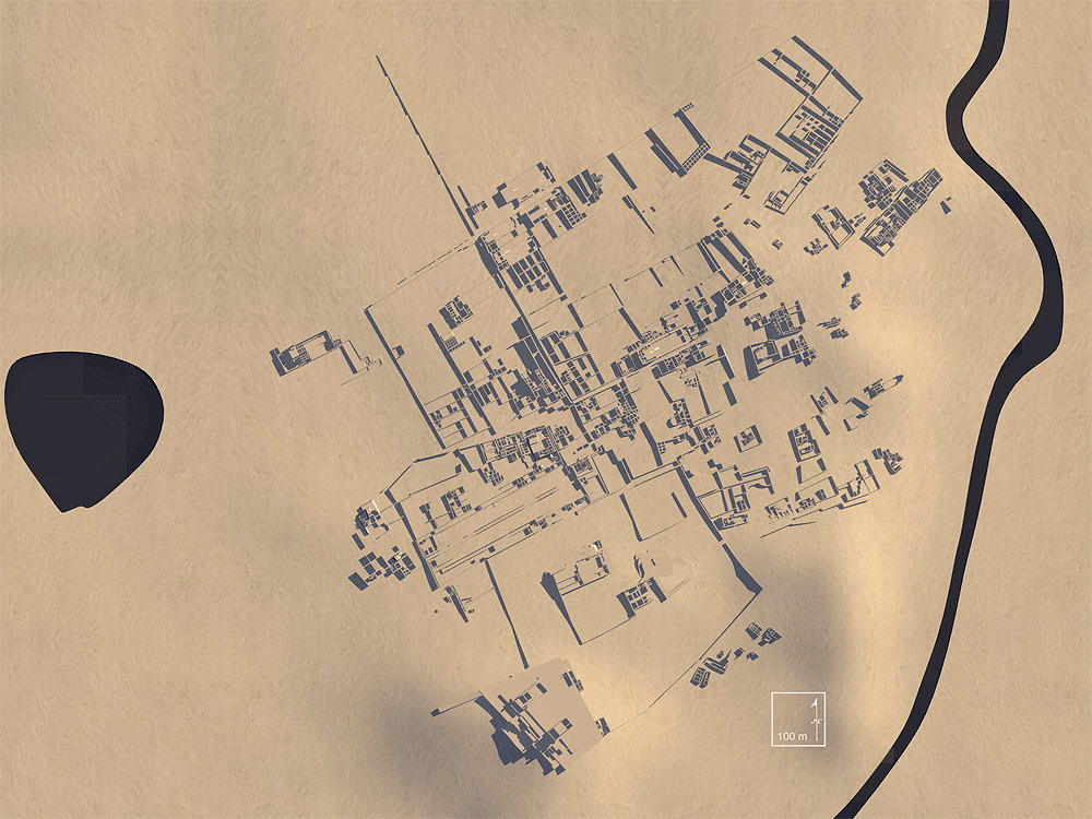
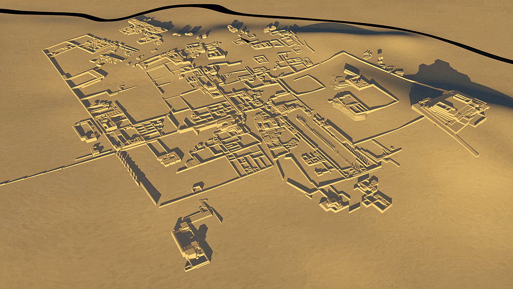
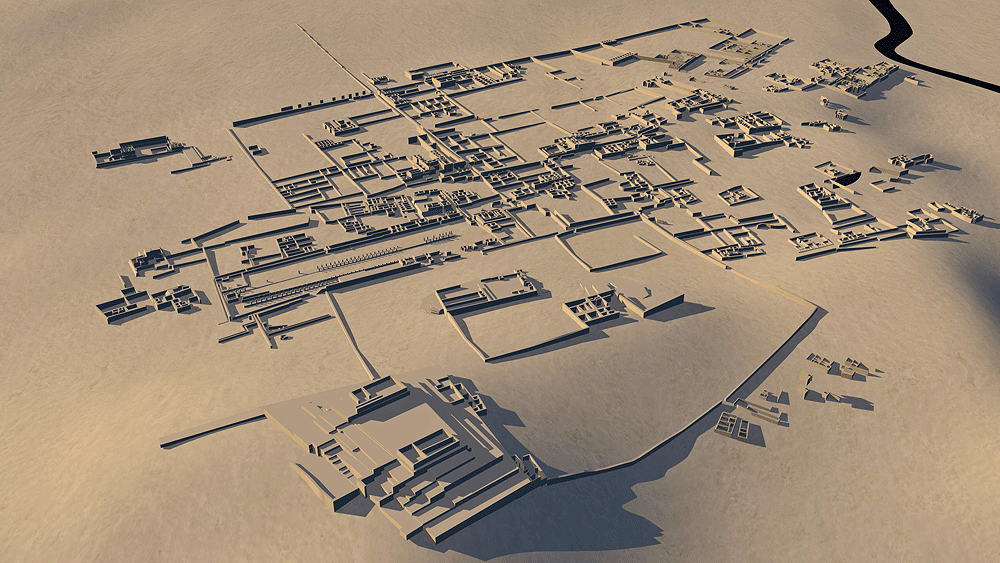
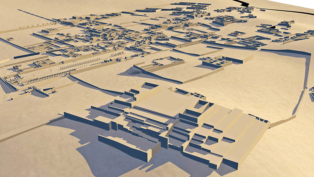
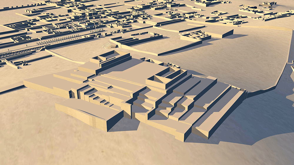
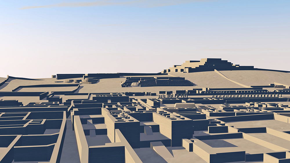
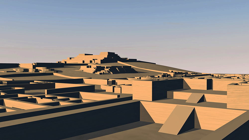
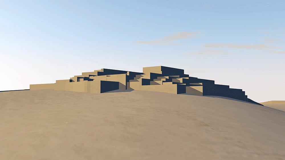
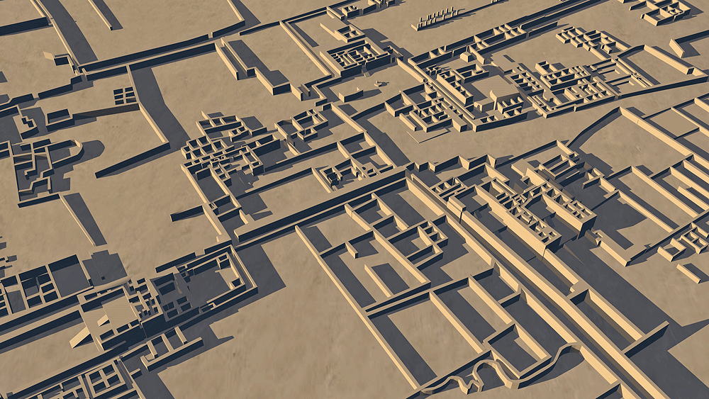
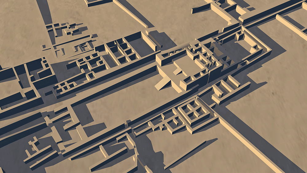
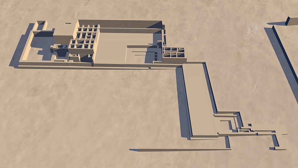
Pachacamac
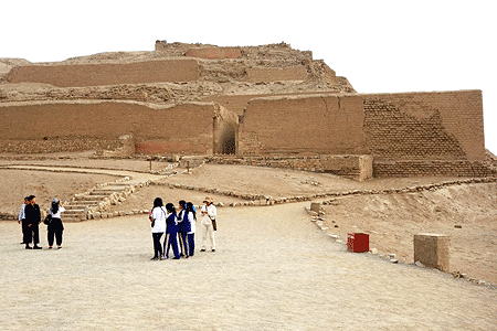
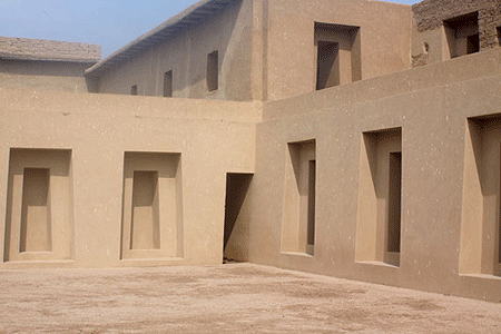
The site of occupation by several cultures, beginning with Lima Culture, around 200 C.E., and subsequently in 650 C.E. by Wari, 1200 C.E. by Ichma, and 1450 C.E. by the Inca; located on the Pacific Coast, in Lurin Valley, southeast of Lima, Peru.
Location coordinates: 12°15'24.4"S 76°54'21.9"W
-12.256781, -76.906072
Elevation is sea level along the Pacific coast.
Materials: adobe over stone.
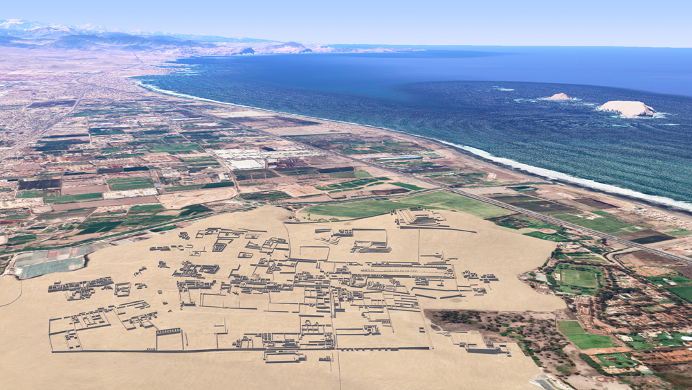
Photomontage of Pachacamac upon aerial photo of actual site looking southeast with the Pacific Ocean and Pachacamac Islands to the right.
Data for CG model:
1. Pozzi-Escot, Denise, (Compiladora), 2014. Pachacamac: Conservación en arquitectura de tierra, Ministerio de Cultura, Lima, Peru.
2. Matsumoto, Go, 1995. Pachacamac GIS Project: A Practical Application of Geographic Information Systems and Remote Sensing Techniques in Andean Archaeology, Kanda University of International Studies, Japan.
( https://www.academia.edu/326537/Pachacamac_GIS_Project_A_Practical_Application_of_Geographic_Information_Systems_and_Remote_Sensing_Techniques_in_Andean_Archaeology ).
3. https://www.google.com/search?biw=1276&bih=1484&tbm=isch&sa=1&ei=g0S5Wv2AEo_gjwO7-b2YCQ&q=Pachacamac%2C+Peru%2C+plano&oq=Pachacamac%2C+Peru%2C+plano&gs_l=psy-ab.12...64379.72182.0.73379.11.11.0.0.0.0.194.1158.5j6.11.0....0...1c.1j2.64.psy-ab..1.3.326...0i5i30k1.0.wLPP0RSaMFo