
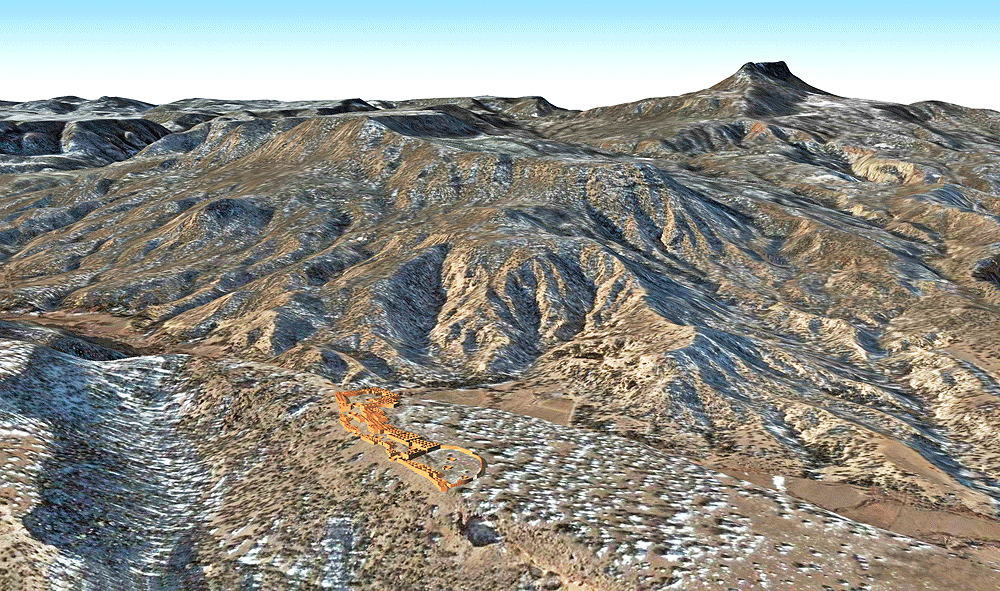
Tsiping (Village of the Flaking Stone Mountain)
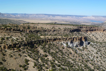
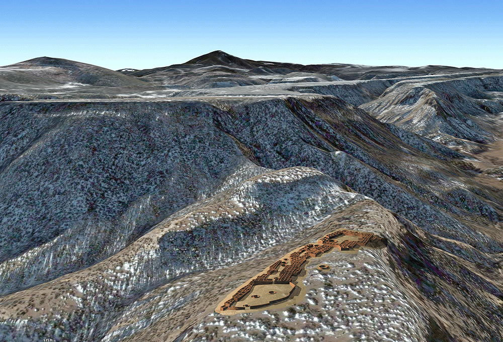
Rio Grande Tewa Ancestral Puebloan Culture, occupied between 1275 C.E. to 1450 C.E., located on a high mesa top near Cerro Pedernal (the flat-topped mountain landmark shown in view 3) near Abiquiu, New Mexico.
Location coordinates: 36°10'09.3"N 106°26'17.1"W
36.169253, -106.438072
Elevation is 2255 meters (7400 feet) above sea level.
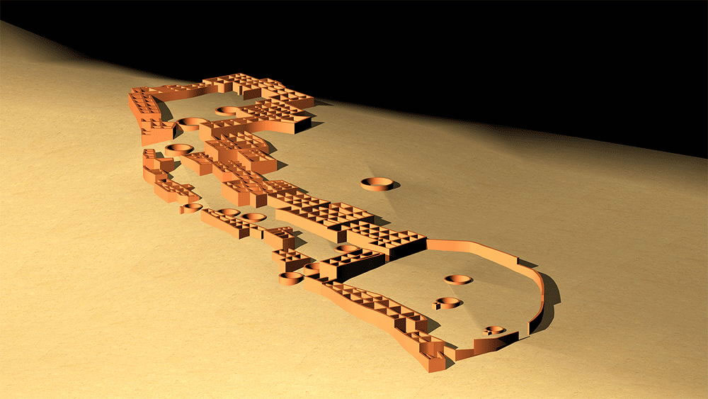
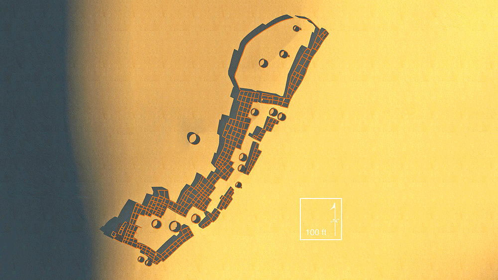
Materials: Pumice (tuff) stone walls; wood log roof structure, with mud/clay roof.
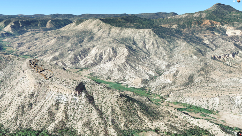
Photomontage of Tsiping Pueblo CG model upon aerial photo of actual site in Jemez Mountains below the iconic Pedernal Mountain.
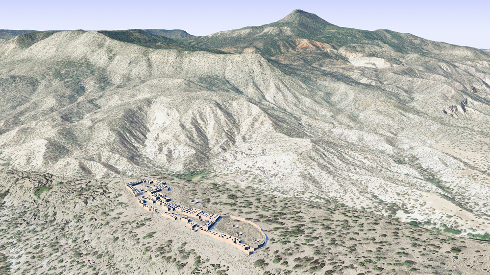
Another photomontage of Tsiping Pueblo CG model upon aerial photo of actual site in Jemez Mountains below the iconic Pedernal Mountain.

Thumbnail panels:
Data for CG model:
1. Morgan, William N., 1994. ANCIENT ARCHITECTURE OF THE SOUTHWEST, University of Texas Press, Austin, Texas.
1. Morgan, William N., 1994. ANCIENT ARCHITECTURE OF THE SOUTHWEST, University of Texas Press, Austin, Texas.
© 2021, Dennis R. Holloway Architect