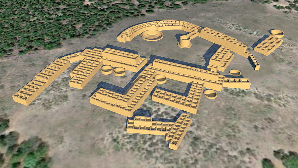
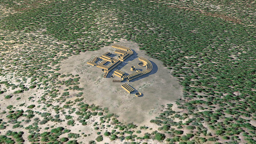
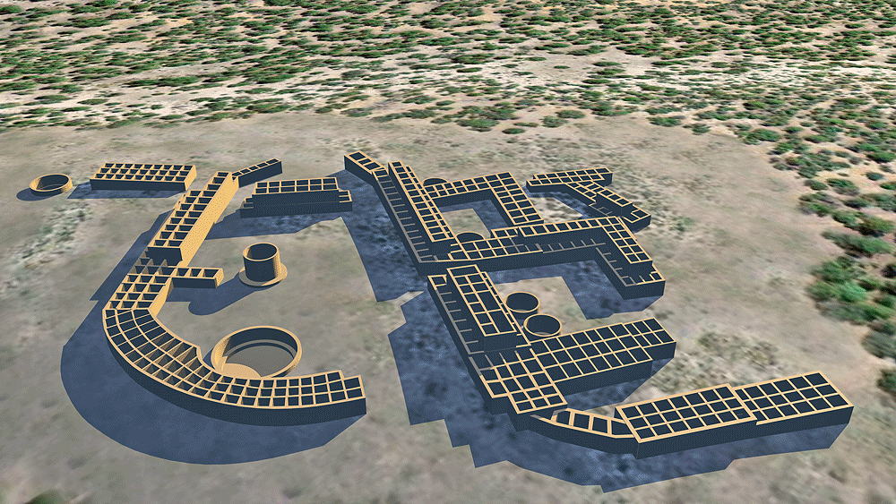
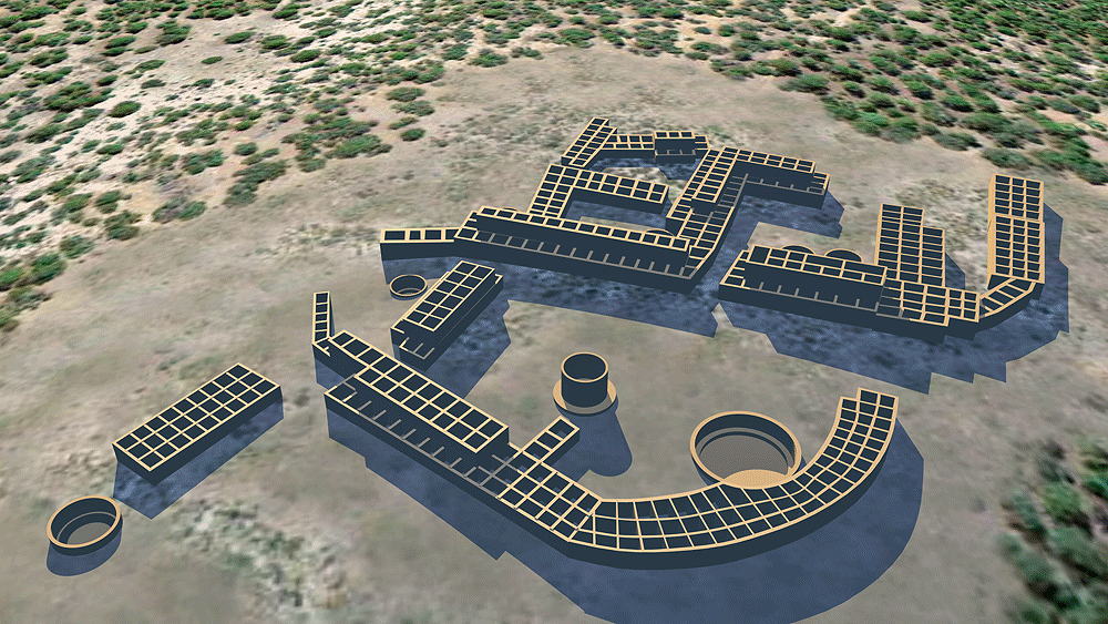
Amoxiumqua Pueblo Ruins ("Old Anthill Place")
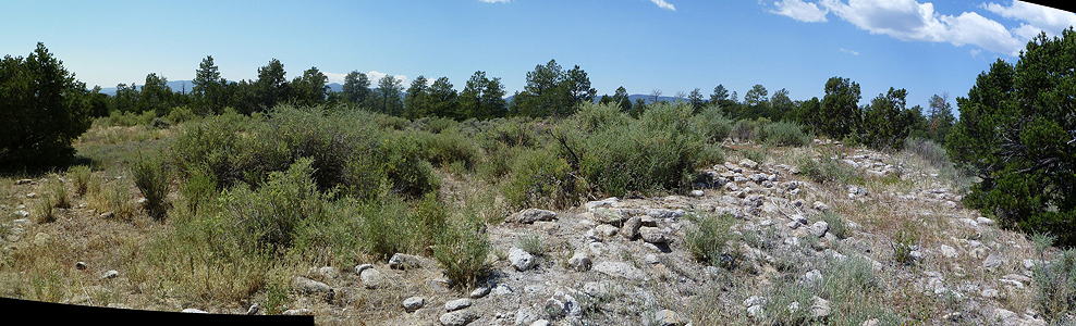
Above: Panorama of Amoxiumqua site, photo by www.otherhand.org
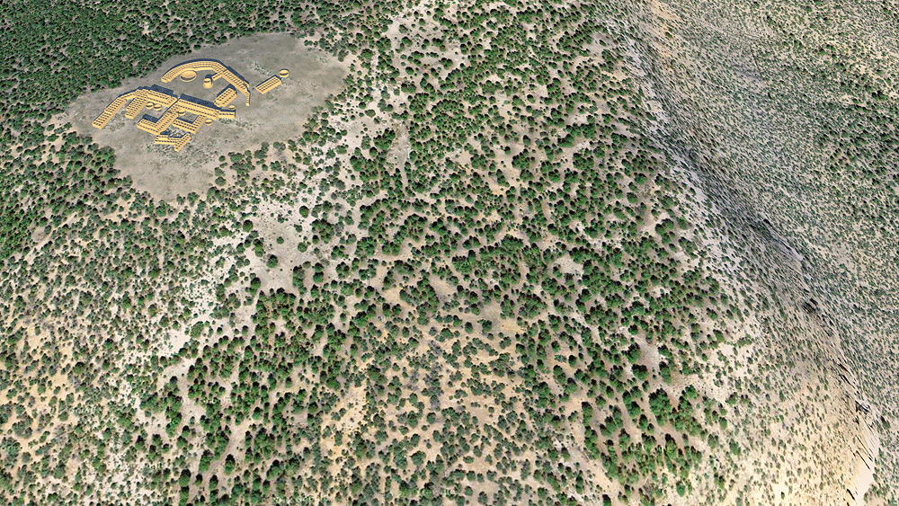
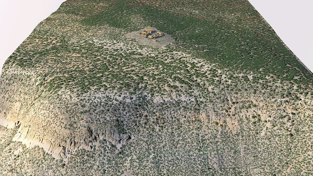
Towa Culture, Ancestral Village of Jemez Pueblo, occupied from 1350 C.E. to 1680 C.E.; located on a high mesatop above and across the Jemez River from the the ancestral village of Giusewa, at Jémez State Monument on N.M. 4, near the town of Jémez Springs, New Mexico.
Location coordinates: 35°46'17.2"N 106°42'52.6"W
35.771439, -106.714600
Elevation is c. 2389 meters (7809 feet) above sea level.
Materials: stone walls, wood log roof structure, with mud/clay roof. 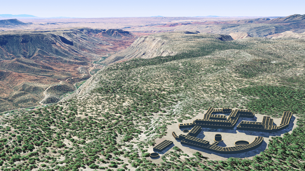
Photomontage of Amoxiumqua CG model upon aerial photo of actual site in the volcanic Jemez Mountains of New Mexico looking south. The Jemez River valley is to the right.
Data for CG model:
1. Published surveys on the Internet. http://www.otherhand.org/home-page/archaeology/amoxiumqua-ruins/
2. Elliot, Michael, Jemez Mountain Research Center, 1986; OVERVIEW AND SYNTHESIS OF THE ARCHEOLOGY OF THE J m E Z PROVINCE, NEW MEXICO, Museum of New Mexico Office of Archaeological Studies, Archeology Notes 51, Santa Fe.
http://www.nmarchaeology.org/assets/files/archnotes/51.pdf