
Five Finger Ridge Hamlet
Fremont Indian State Park, near Sevier, Utah
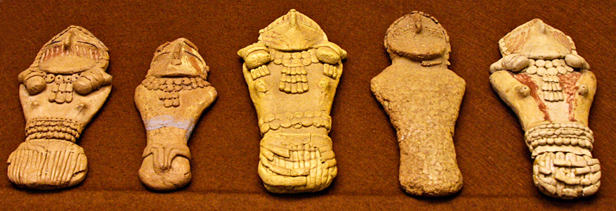
Above: Pilling Figurines, unfired clay Fremont figurines, on display in the College of Eastern Utah Prehistoric Museum.
The summit of Five Finger Ridge south of I-70, west of Sevier, Utah, iis about 100 feet (20 meters) higher that Clear Creek flood plain. It is a hamlet site of the Fremont people, whose culture lived, hunted, and planted corn in Utah and Nevada. The Fremont were adjacent to, contemporaneous with, but distinctly different from Ancestral Puebloan peoples to their south, although some members of the Jemez Pueblo (Towa culture) say the Fremont people are their ancestors.
Five Finger Ridge hamlet is strategically located for best solar access, stronger wind ventilation, overview of the canyon below, easier defense from enemies, and to leave the flood plain (with its mosquitos) for agricultural use. Archaeologists have unearthed 100 distinct structures, including 60 pit-houses, 19 storage granaries, and borrow pits.
All of the pit-houses shown in the CG model shown here were not occupied at the same time, but over the life-span of the village. The first pot-houses were built on the ridge between 1100 CE and 1150 CE and were later added to in 1200 CE. at the top of the ridge and also 80 feet lower on the west finger. Some of the later pit-houses were built over previously abandoned pit-houses. The pit-house and storage structure on the western finger were built around 1350 CE. So the largest population of 60-100 inhabitants was in only 12 of the pit-houses in the late 1200's CE.
Elevation is 1829 meters (6000 feet) above sea level.
Location coordinates: 38°34'27.7"N 112°20'15.9"W
38.574360, -112.337748
Materials of construction: Mortaless stone masonry walls, with log upper floors and roof supports, and cedar purlins supporting mud/clay roofing.
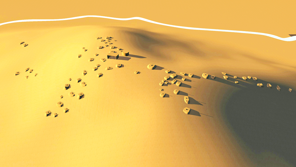
CG model of Five Finger Ridge pithouse village looking north.
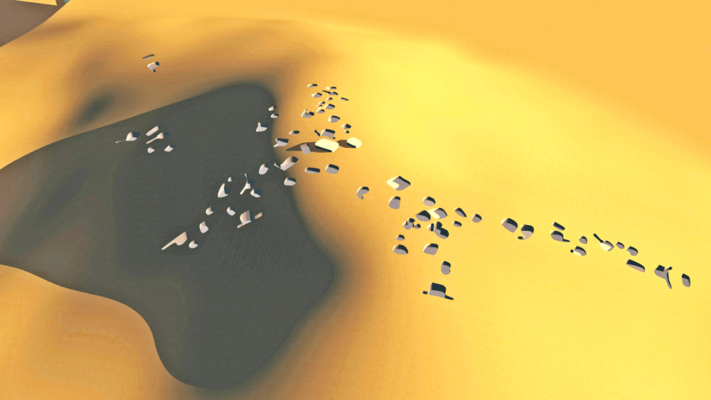
CG model of Five Finger Ridge village showing excated pits (without roof structures), lookin northwest.
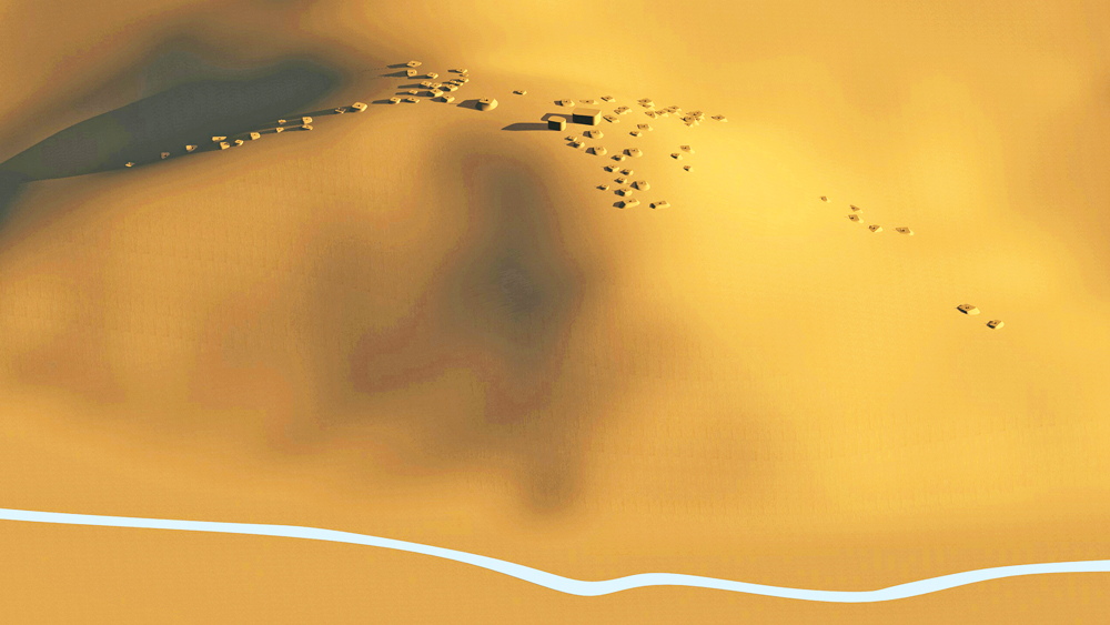
Looking south.

Five Finger Ridge pithouse village site plan with scale and orientation.
Data for CG model:
1.Allison, James R. 2008. Human Ecology and Social Theory in Utah Archaeology. Department of Anthropology, Brigham Young University