
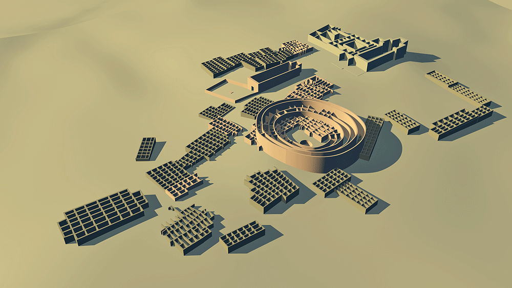
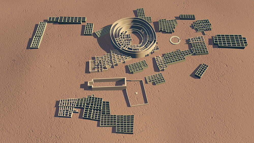
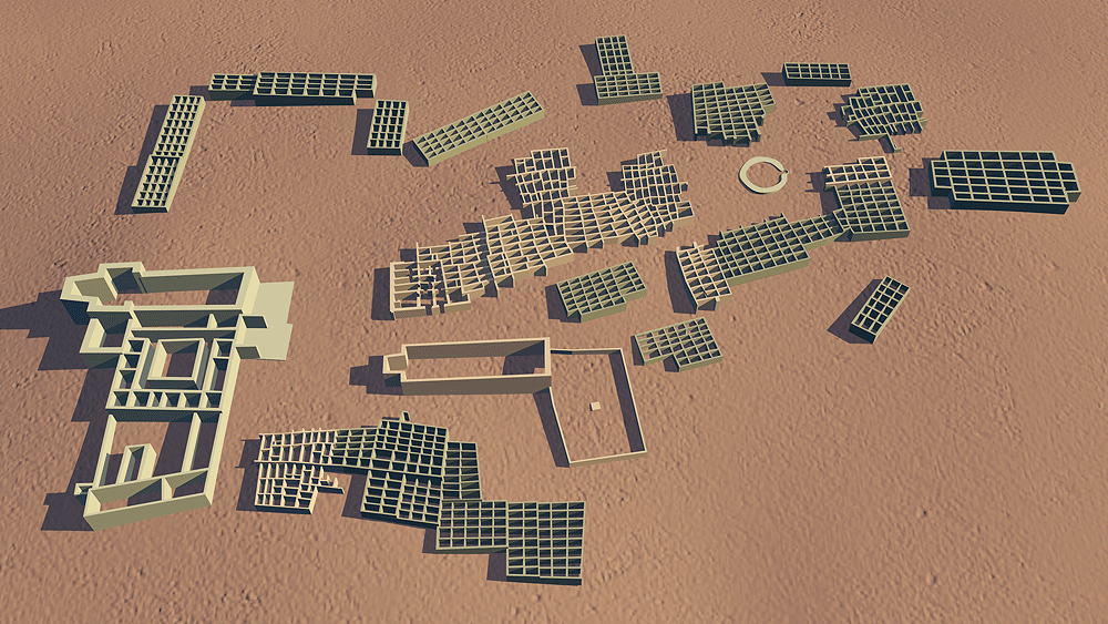
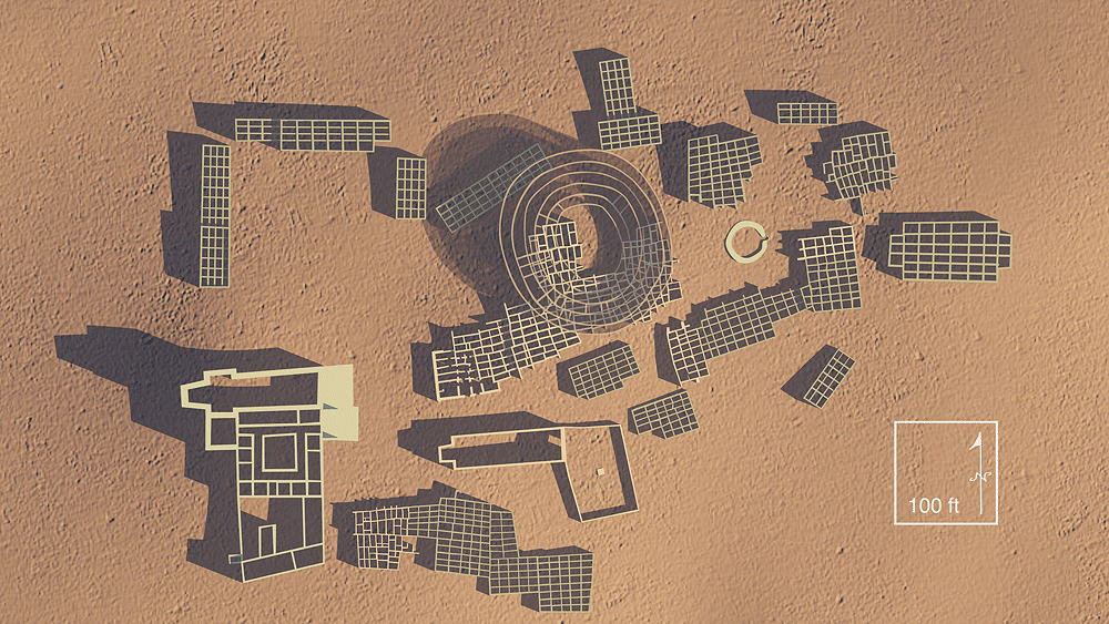
Gran Quivira Pueblo
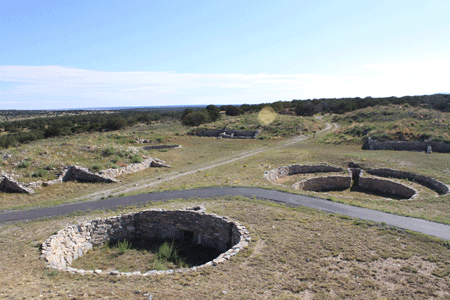
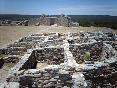
Tiwa and Tampiro Cultures ancestral village, and major pre-Columbian trading center, was built c.1300 CE and inhabited until the Pueblo Revolt of 1680 C.E.; located in the Salinas Missions National Monument, in the Salinas Basin near Mountainair, New Mexico.
Location coordinates: 34°15'36.0"N 106°05'29.2"W
34.260011, -106.091442
Elevation is 1991 meters (6533 feet) above sea level.
Materials: mortarless stone walls, wood log roof structure, with mud/clay roof.
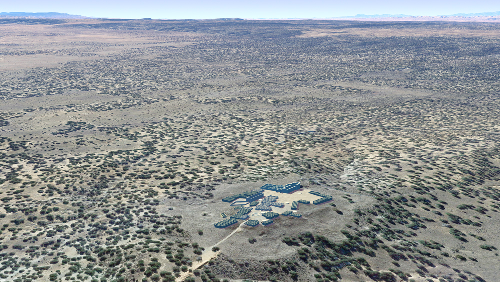
Photomontage of Gran Quivira Pueblo upon an aerial photo of the actual site.


Thumbnail panels:
Data for CG model:
1.Ivey, James E.,1988. IN THE MIDST OF A LONELINESS, THE ARCHITECTURAL HISTORY OF THE SALINAS MISSIONS, Salinas Pueblo Missions National Monument Historic Structure Report, Southwest Cultural Resources Center, Professional Papers No. 15. Santa Fe, New Mexico.
1.Ivey, James E.,1988. IN THE MIDST OF A LONELINESS, THE ARCHITECTURAL HISTORY OF THE SALINAS MISSIONS, Salinas Pueblo Missions National Monument Historic Structure Report, Southwest Cultural Resources Center, Professional Papers No. 15. Santa Fe, New Mexico.
© 2023, Dennis R. Holloway Architect