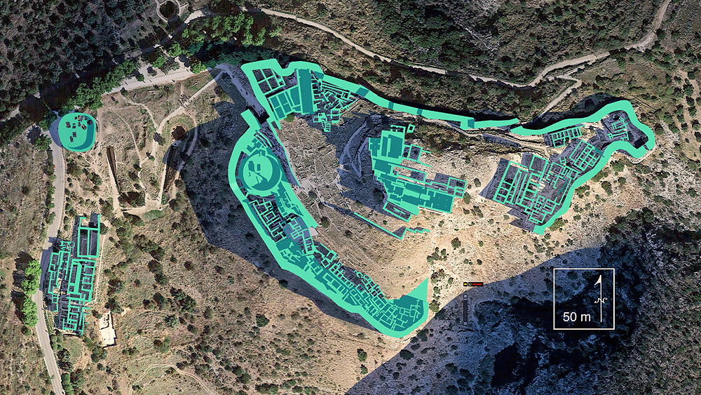
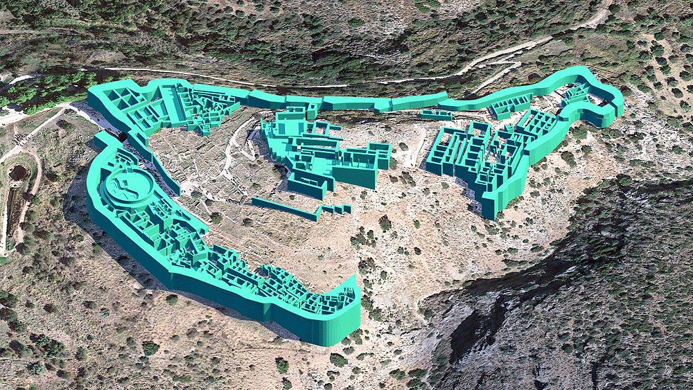
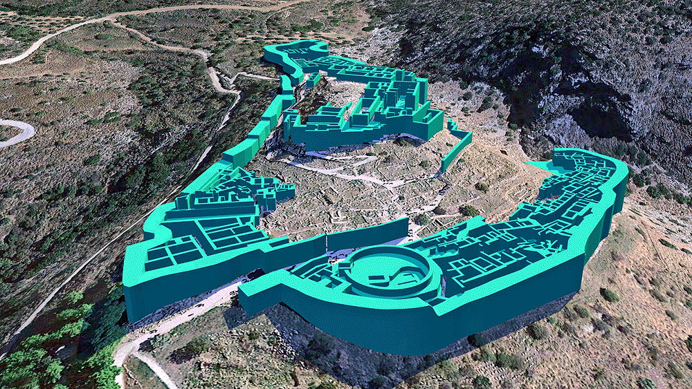
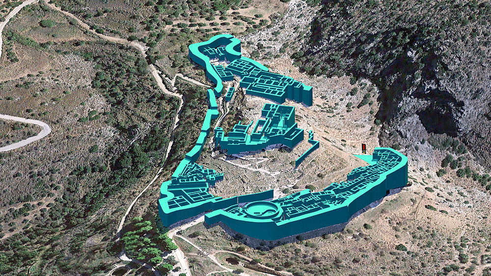
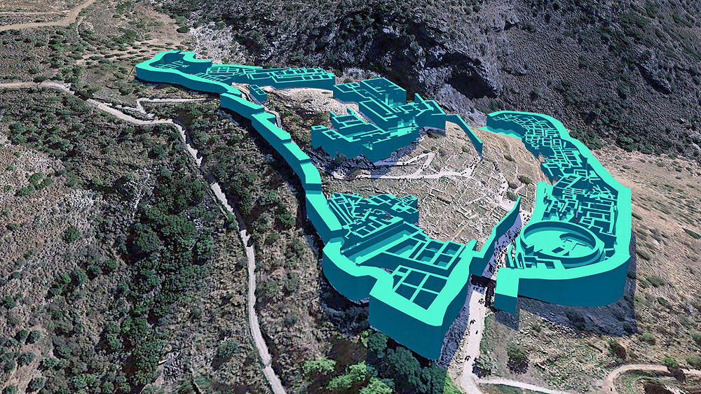
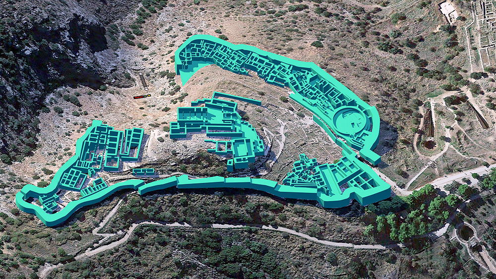
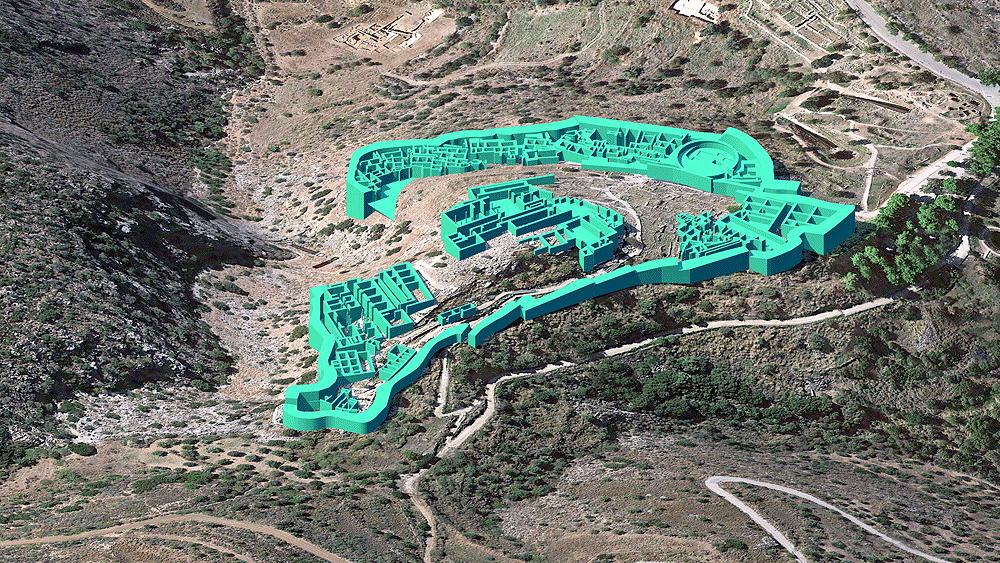
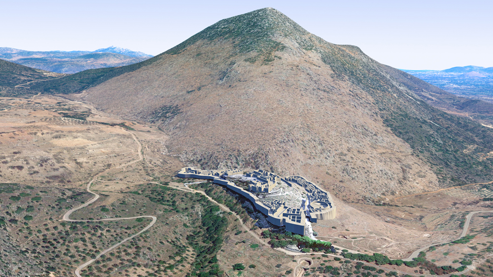
Mycenae
Greek Mycenaean Civilization, acropolis site occupied continuously from the Neolithic Period, c. 10,000 B.C.E. until decline around 1200 B.C.E. During the Bronze age (circa 1600-1100 BCE) it became a major Greek center, with military command of southern Greece, he Aegean islands, and the shores of Asia Minor. In 1350 B.C.E. population of the citadel and lower town was around 30,000.
Mycenae is near Mykines in Argolis, north-eastern Peloponnese, Greece. It is located about 120 kilometres south-west of Athens; 11 kilometres north of Argos; and 48 kilometres south of Corinth.
Location coordinates: 37.730003, 22.756860
Elevation is c. 262 meters (861 feet) above sea level.
Materials: "Cyclopean" ashlar stone walls, and roofs of wood beams, thatch and flagstone.
Data for CG model:
1. Biers,William R., 1980, The Archaeology of Greece, An Introduction (Revised Edition); Cornell
University Press, Ithica-London
2. Coulton, J.J., 1977. Ancient Greek Architects at Work, Cornell University Press, Ithica, N.Y.
3. Hooker, J.T., 1976, Mycenaean Greece, Department fo Greek, University College, London, Routledge & Kegan Paul, London, Henley and Boston
4. Ancient -Greece.org: https://www.ancient-greece.org/archaeology/mycenae.html
5. The Metropolitan Museum: https://www.metmuseum.org/toah/hd/myce/hd_myce.htm
6. Wikipedia: https://en.wikipedia.org/wiki/Mycenae