Piedras Negras
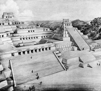
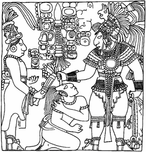
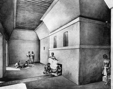
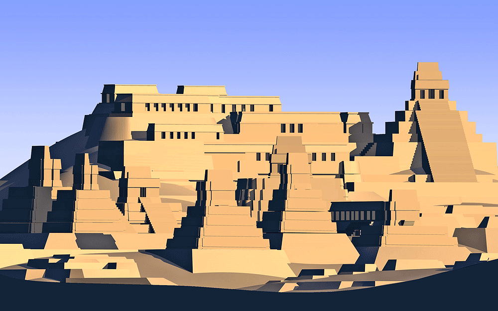
Above left: Perspective drawing of The Acropolis of Piedras Negras by Tatiana Proskouriakoff, 1909; Above middle: Drawing from stone depiction of the unfortunate end of the Piedras Negras Royal, T'ul Chik, under the hands of his warring ememies from La Pasadita; Above right: Perspective drawing of the Sweat Bath at Piedras Negras, by Tatiana Proskouriakoff, 1909.
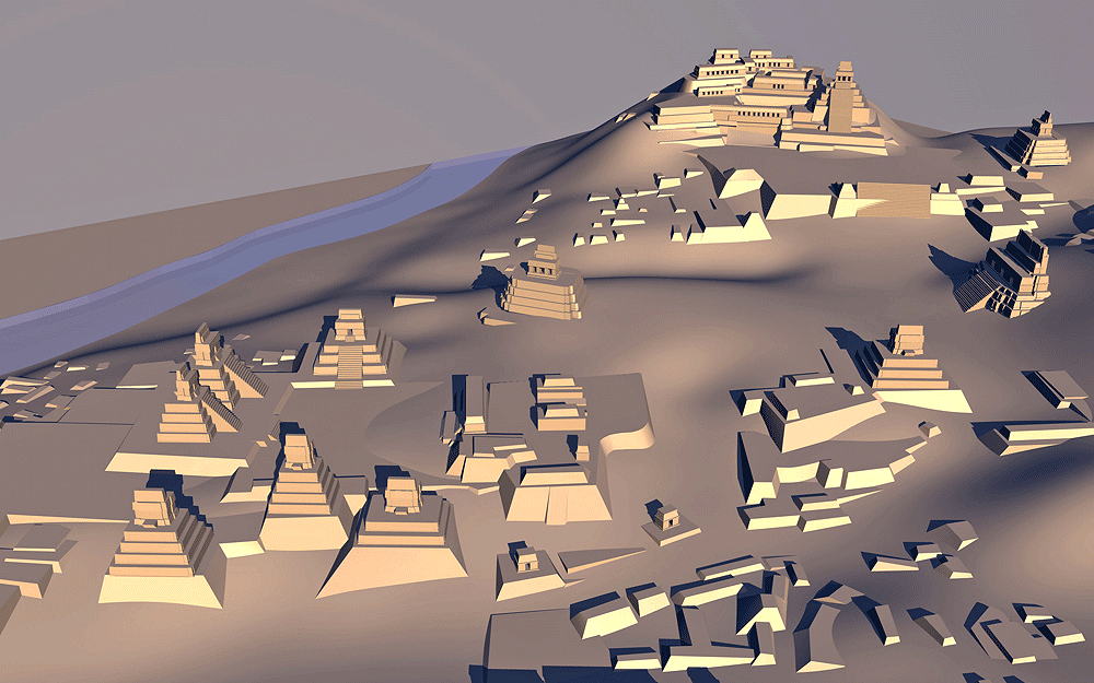
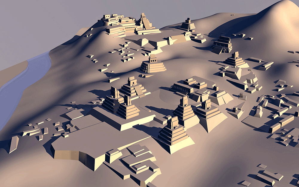
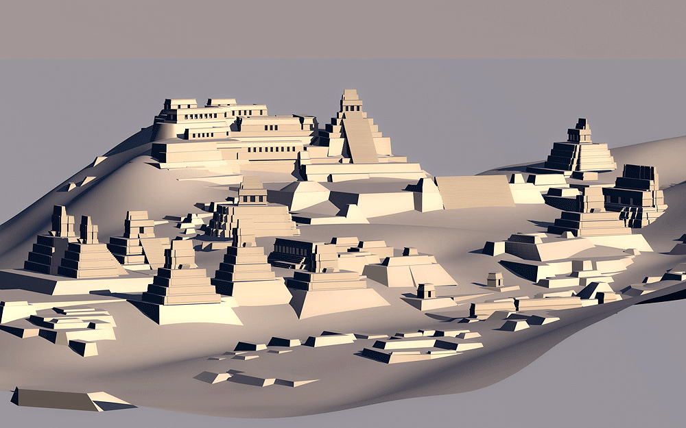
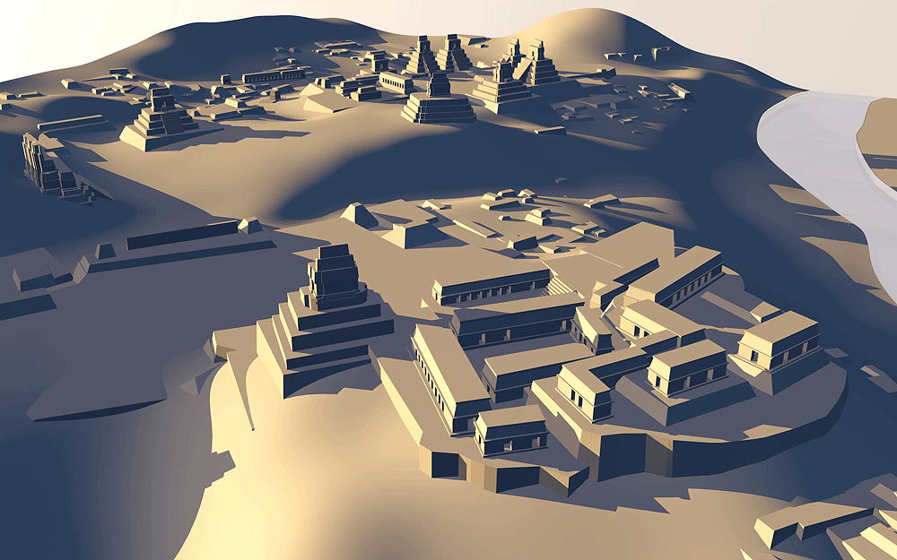
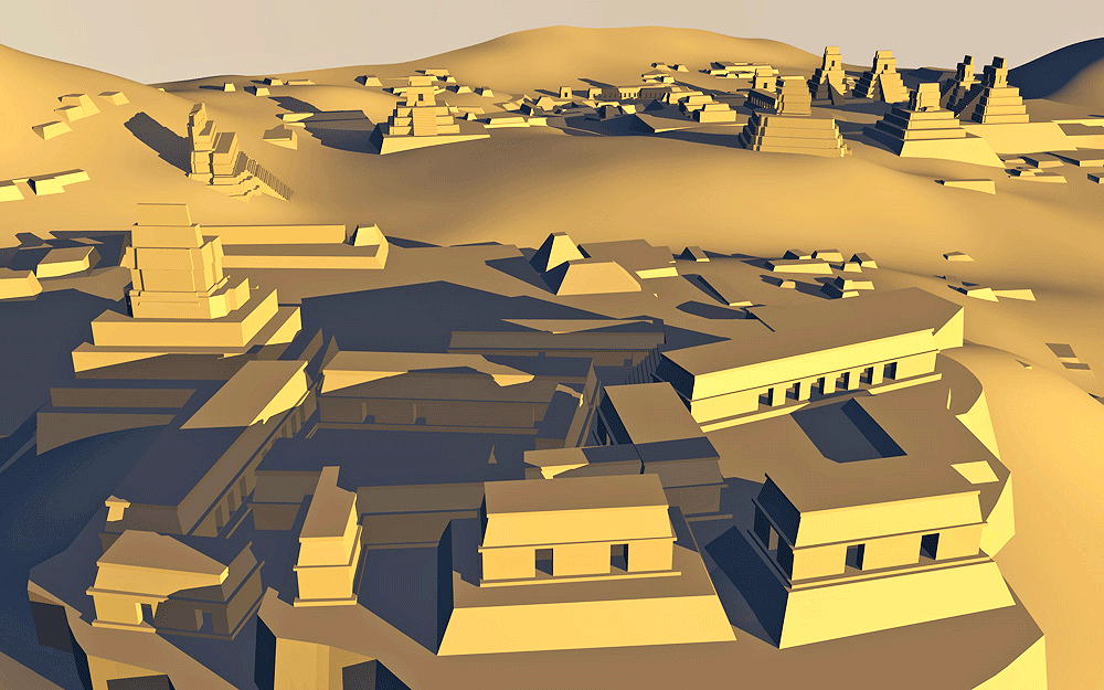
Maya Civilization from Late Pre-Classic to Classic Period, 200 B.C.E.- 800 C.E.; located on the Usumacita River in Petén department of Guatemala. This city was a major trading route, and as such, it superb scuptures and stelae represent influence from many other Mayan places.
Location coordinates: 17°10'12.6"N 91°15'51.0"W
17.170173, -91.264162
Elevation ils c. 114 meters (375 feet) above sea level.
Materials: stone.
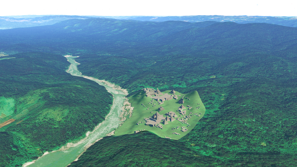
Photomontage of Piedras Negras upon photo of actual site on the Usumacita River, looking north.
Data for CG mode
1.Proskouriakoff, Tatiana, 1946. An Album of Maya Architecture, Carnegie Institution of Washington, Washington, DC.
2.Map: Ruins of Piedras Negras, Department of Peten, Guatemala, The University Museum, University of Pennsylvania,1959.
3.Satterthwaite, Jr., Linton , Butler, Mary , and Mason, J. Alden, 1931-1939. Piedras Negras Archaeology, , Piedras Negras Preliminary Papers, Edited by John M. Weeks, Jane Hil, and Charles Golden, University of Pennsylvania Museum of Archaeology and Anthropology, Philidephia, PA, 2005