
Shumway Pueblo
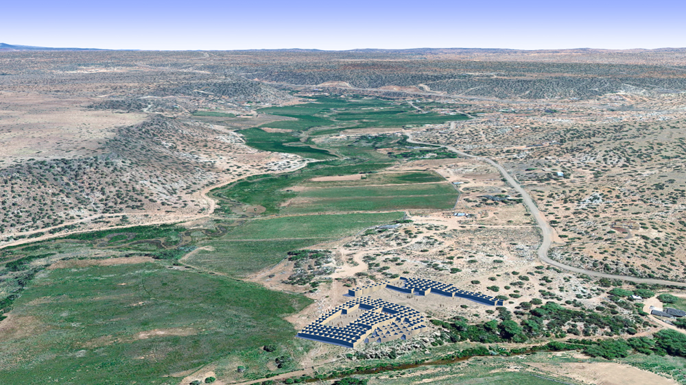
Above: Photomontage of Shumway Pueblo CG model upon aerial photo of actual site, lookin south.
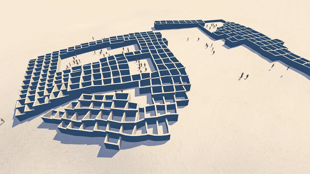
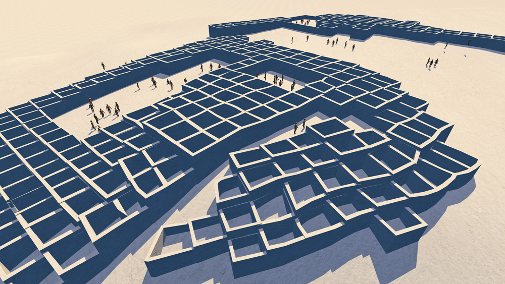
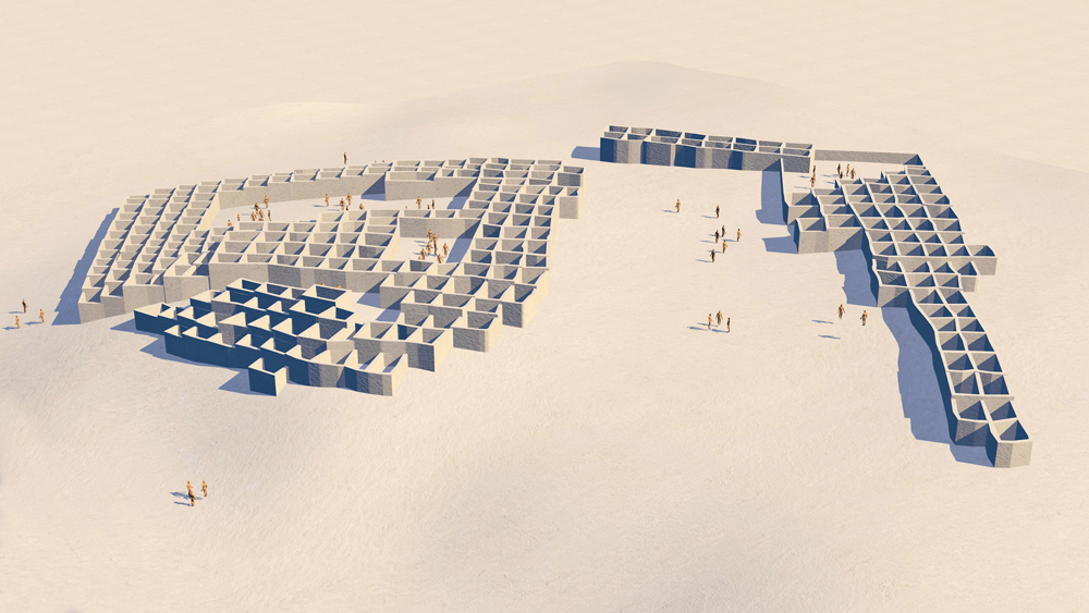
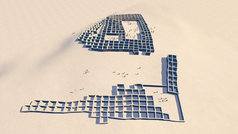
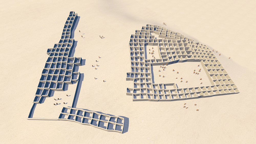
Shumway Pueblo Ruin is a large Ancestral Puebloan settlement in east-central Arizona occupied during the14th century C.E. The settlement was one of six villages in the Silver Creek drainage established during a phase of community reorganization throughout the Southwest. The plan of the village was composed of several room blocks builaround two major plazas and a smaller plaza. Shumway was one of the latest occupied Pueblo villages in the region and was a source of iconographic-style red ware pottery. During the peak of occupation the pueblo could have had up to 350 to 400 masonry rooms, including second story rooms. (See also Fourmile Pueblo on this web site.)
Elevation is 1731 meters (5680 feet) above sea level.
Coordinates: 34°25'20.3"N 110°04'11.6"W
34.422315, -110.069875
Materials of construction: stone masonry with mud plaster, tree log upper floor supports and roof supports, with mud/clay roofing on river bank sappling mats.
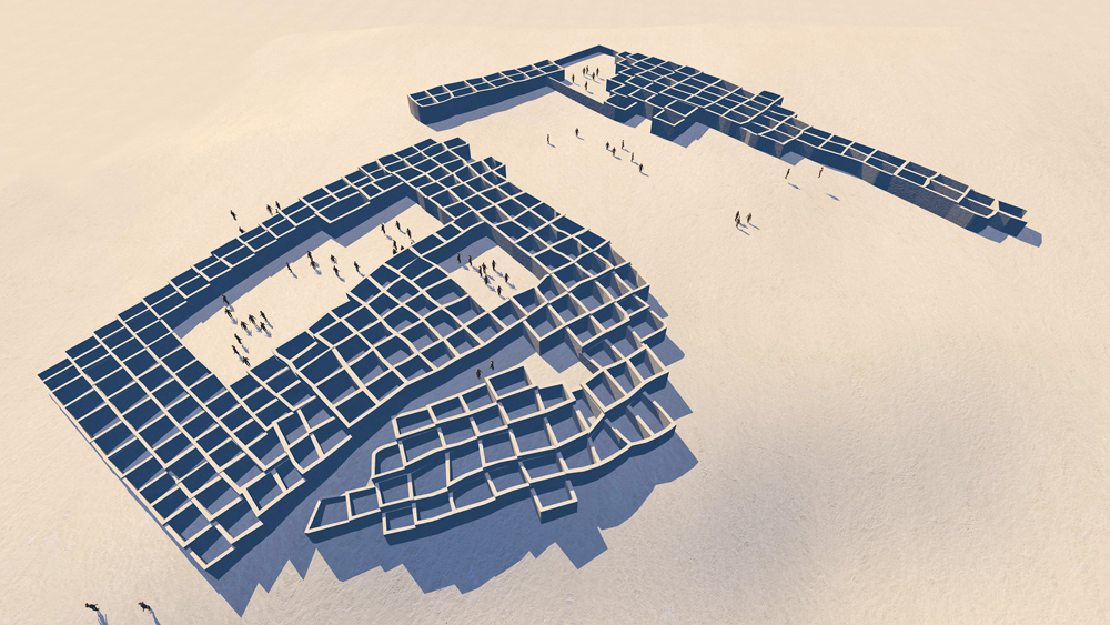
Looking south.
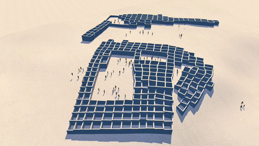
Looking southwest
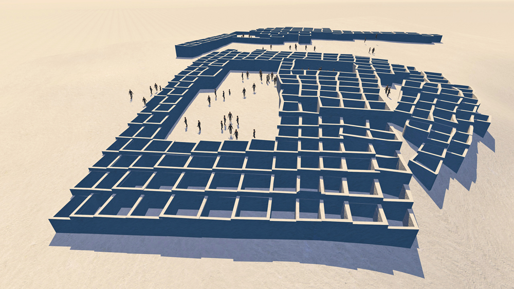
Looking southwest.
Looking southeast
Looking south.
Looking southeast.
Looking southwest.
Looking northwest.
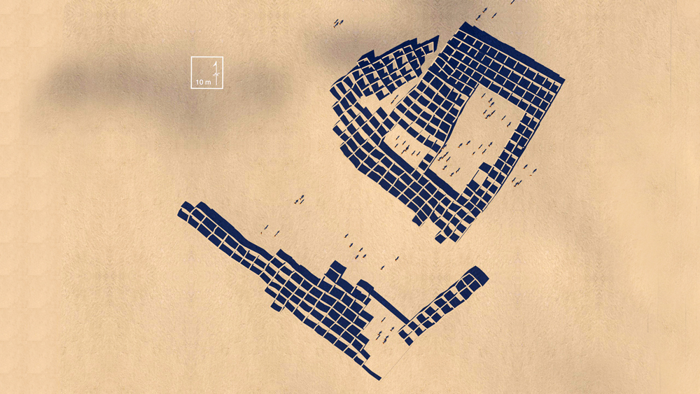
Plan view with scale and orientation.
Data Source for CG model:
1. Shumway Archaeologica Project: https://www.uvm.edu/~svankeur/SHAP/project_area/fourmile_ruin/fourmile.htm
2. Van Kueren,Scott, 2006. Shumway Ruin and the Late Pre-Hispanic Period in East-Central Arizona. in Contributions in Science, Number 508, 8 June 1006, Natural History Museum of Los Angeles County 2006.