
Snaketown, Arizona
Snake Town is a Hohokam archaeological site located on the Gila River Indian Reservation near Sacaton, about 30 miles southeast of Phoenix, Arizona. The name "Hohokam" is from the contemporary Tohono O'odham tribe meaning "those who have gone". Evidence of dates of this ancient habitation are not definitive, but are generally thought to be 300 BCE and 1200 CE. Who these inhabitants were and when they built the village is still a scientific debate. The people were farmers in a hot extremely arid area of sandy soil, intermittent river flows, and volcanic mountains. Their crops were the "thee sisters", maize, beans, and squash as well as tobacco, agave, and cotton. For their agriculture of 70,000 acres of land, they engineered a vast network of irrigation canals (some 10 miles long), channeling water from the nearby Gila river. They also supplemented their diet with small amounts from hunting and gathering.
Pit houses, in a rounded rectangular form, were constructed over shallow earth depressions. A structure, like a four- leg table, was then constructed of logs to support the roof/walls of arching sapplings, brush and adobe mud. The houses were clustered aroung plazasEstimates of the population of the village range from 1000 to 3000. More than sixty midden mounds were found at the site. This culture practiced cremation, and eight areas used as crematoria were excavated.
During excavation of the site, oval shaped depressions were initially identified as ballcourts, connecting the culture of the village to Central America. Archaeologists, debating this, have concluded that instead, these were ceremonial dance floors similar to those used by local the Papago people until the mid-20th century.
Archaeologists found evidence of a thriving pottery and shell jewellery industries, and trade with Central America from the copper bells and figurines found at the site.
The site has U.S. National Historic Landmark designation; it is not open to the public.
Elevation is 365 meters (1200 feet) above sea level.
Coordinates: 33.1875°N 111.9245°W
Materials: Structures of bent marsh sapplings, covered with brush and mud plaster surface, and interior primary 4-post tree log support.
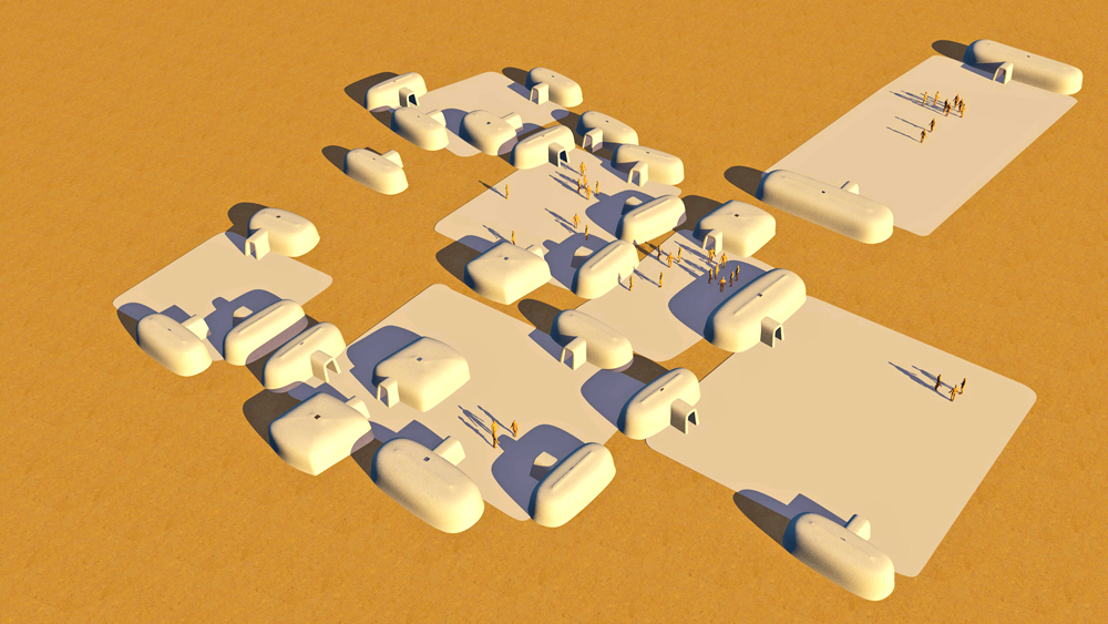
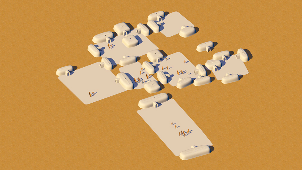
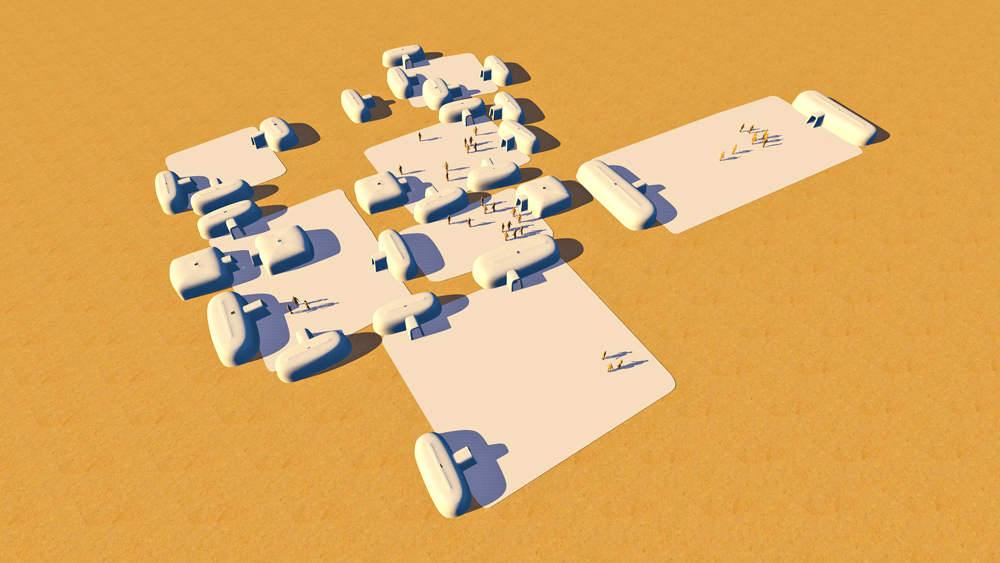


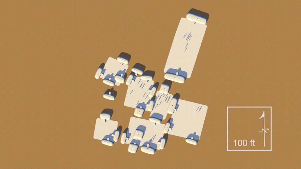
Data for CG model:
1. Morgan, William N., 1994. ANCIENT ARCHITECTURE OF THE SOUTHWEST, University of Texas Press, Austin, Texas.
2. Crown, Patrica L. and Judge, James W, editors. Chaco & Hohokam: Prehistoric Regional Systems in the American Southwest. School of American Research Press, Santa Fe, New Mexico, 1991.
3. Haury, Emil W. 1976. The Hohokam Desert Farmers and Craftsmen – Excavations at Snaketown, 1964–65. The University of Arizona Press, Tucson.
4. Gladwin, Harold S. and Winifred; Haury; and Sayles 1938. "Excavations at Snaketown: Material Culture." Medallion Papers. Gila Pueblo, Globe, Arizona. Reprinted 1965 by the University of Arizona Press, Tucson.