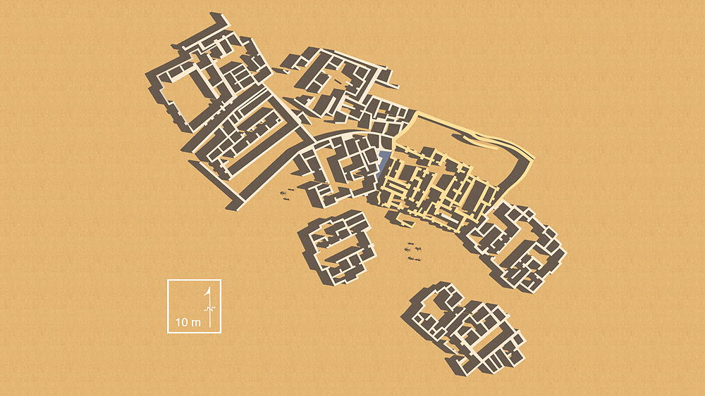
Tell Abada
The site location is east of the Diyala River, Hamrin region east of Bagdad, along the Zagros foothills bordering the eastern frontier of present day Iraq. Archaeological excavation was conducted to salvage information about the site, prior to inundation from the completion of a large nearby dam. The oval settlement site, 190 m long by 150 m wide, sits upon a mound 3.5m above the surrounding plain. Three main stratigraphic units number I-III were excavated on the top of the mound. The earliest settlement, Level III, was built during the transitional stage between the Samarra and Ubaid I, dated by the styles of pottery found (5400–4700 BCE).
Level III, the earliest construction on the site, was built directly upon the virgin soil.
Two multi-roomed houses with rectangular courtyards were uncovered, the floors and walls of which were coated with a layer of gypsum plaster. Large storage jars, with red ochre, the grinding stone used to prepare it, and a large oven, suggests that these buildings were used for pottery making. Samarra and Eridu-Ubaid I pottery wares were found (c. 6500–3800 BC)
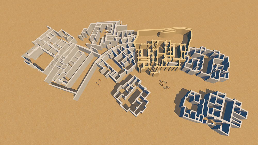
Level II, the best preserved and most expansive construction on the site, exhibits the growth and wealth of the village; the plan had eleven large buildings. accessed by narrow streets. The houses have tripartite plans with T-shaped courtyard and several rooms, and were tightly nucleated typical of early Ubaid 3, (5300–4700 BCE). Large adobe mud bricks were used to construct the walls, which were plastered with levigated clay (ie, washed to separate the it from coarse particles). Floors were paved with mud bricks or covered with beaten clay. In the excavation of one of the houses large pieces of mud with impressions of reed were found in different places of the central cruciform hall, indicating that this part of the building had been roofed with timber and reed matting and covered with mud. Entrance doors were at ground level. One of the central buildings had buttressed exterior wall and three T-shaped courtyards, with adjacent small rooms in which a large quantity of Ubaid II style and incised pottery was found. Some evidence of stairways to the roofs or possible upper stories were found.
Level I remaining buildings followed the plans of their predecessors of Level II.
Elevation is 350 m (1150 ft) above sea level.
Sources of date for the CG model:
1.Jasim, S.A., 1981; Excavation at Tell Abada, Iraq, article in Paléorient, 1981, vol. 7, no. 2, Pluridiscliplinary review of prehistory and protohistory of southwestern Asia.
https://www.persee.fr/doc/paleo_0153-9345_1981_num_7_2_4302
2.Sanders, Akiva, 2020; An aesthetic of resistance: Beauty and power in northern Mesopotamia, article in Journal of Anthropological Archaeology, September, 2020.
https://www.researchgate.net/publication/341383168_An_aesthetic_of_resistance_Beauty_and_power_in_northern_Mesopotamia
3. Ur, Jason. 2014. Households and the Emergence of Cities in Ancient Mesopotamia, Cambridge Archaeological Journal 24 (02) (June)
http://nrs.harvard.edu/urn-3:HUL.InstRepos:12490321
4. Mardas, Joanna, 2019; Development of settlement in the Northern Iraq
since Hassuna till Ninevite 5 period (6500-2600 BC), Praca doktorska napisana pod kierunkiem, Prof. dr. hab. Rafała Kolińskiego, UNIWERSYTET IM. ADAMA MICKIEWICZA WYDZIAŁ HISTORYCZNY, Poznań 2019
https://repozytorium.amu.edu.pl/handle/10593/25659