Ur
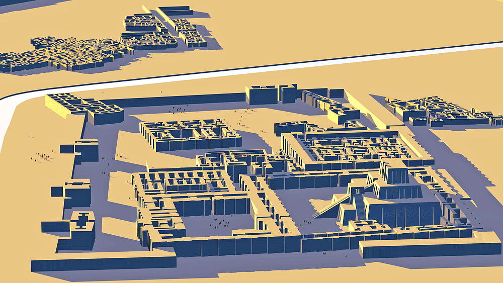
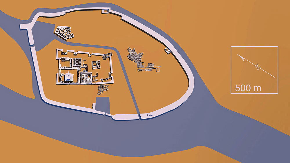
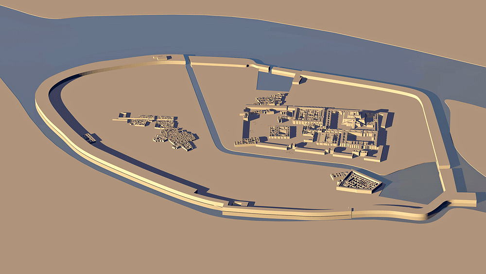
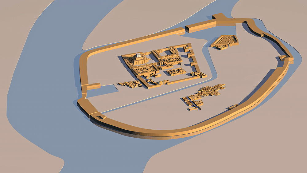
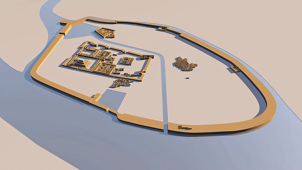
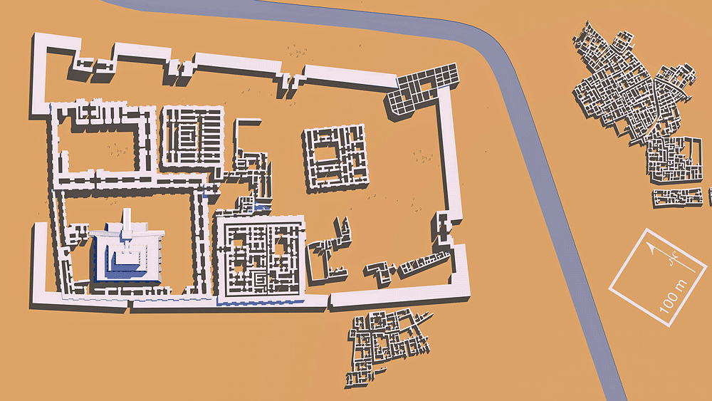
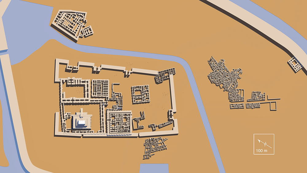
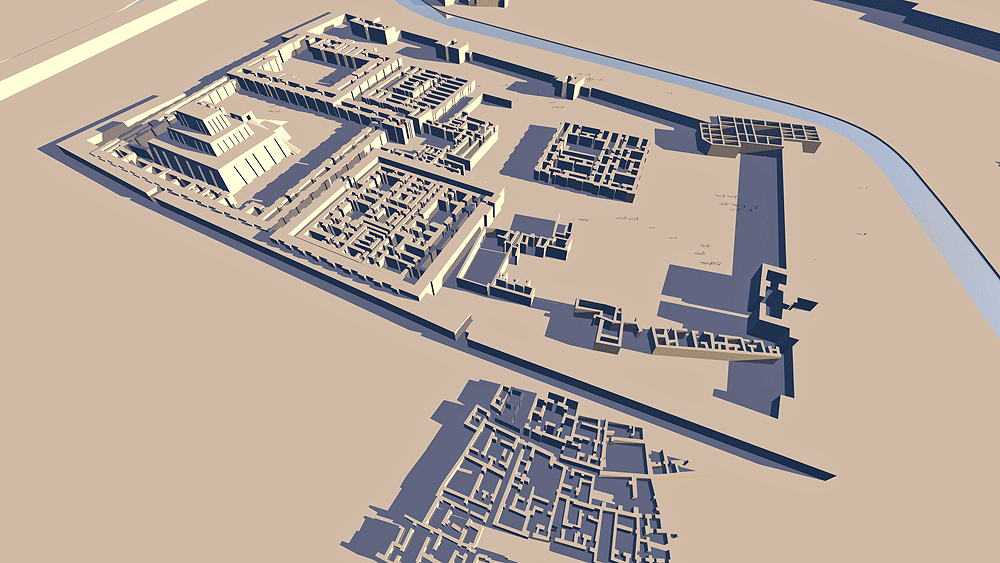
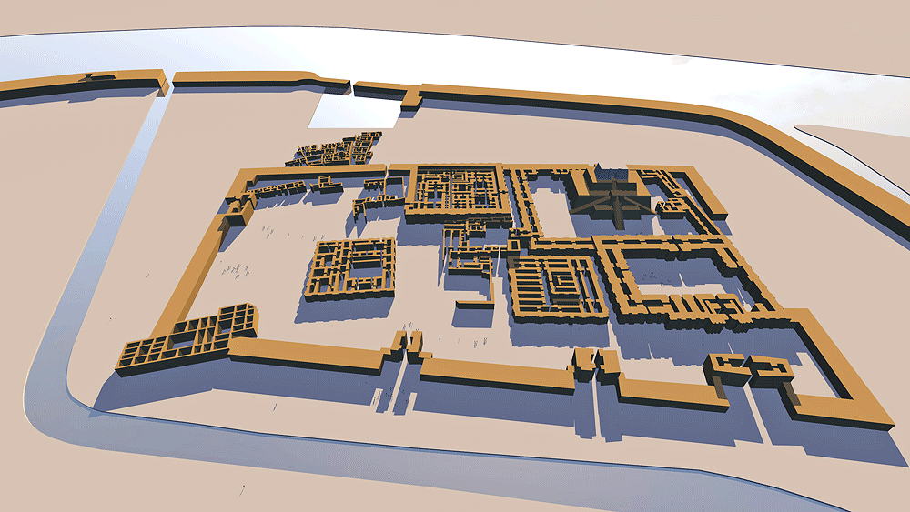
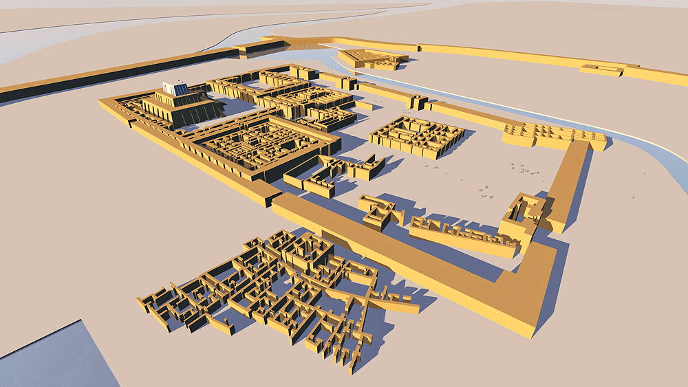
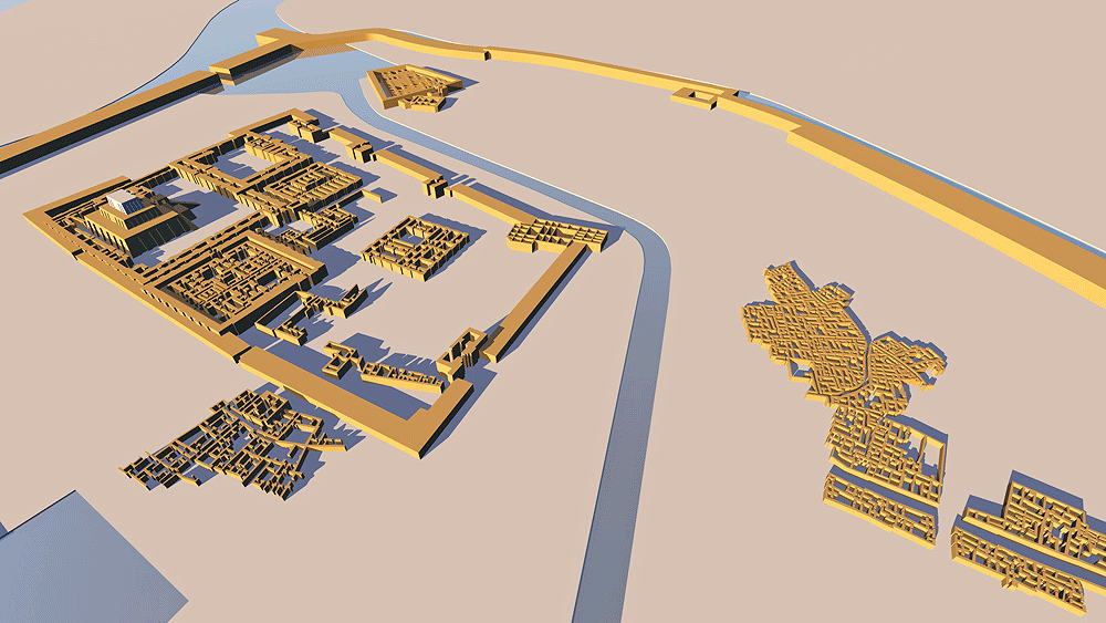
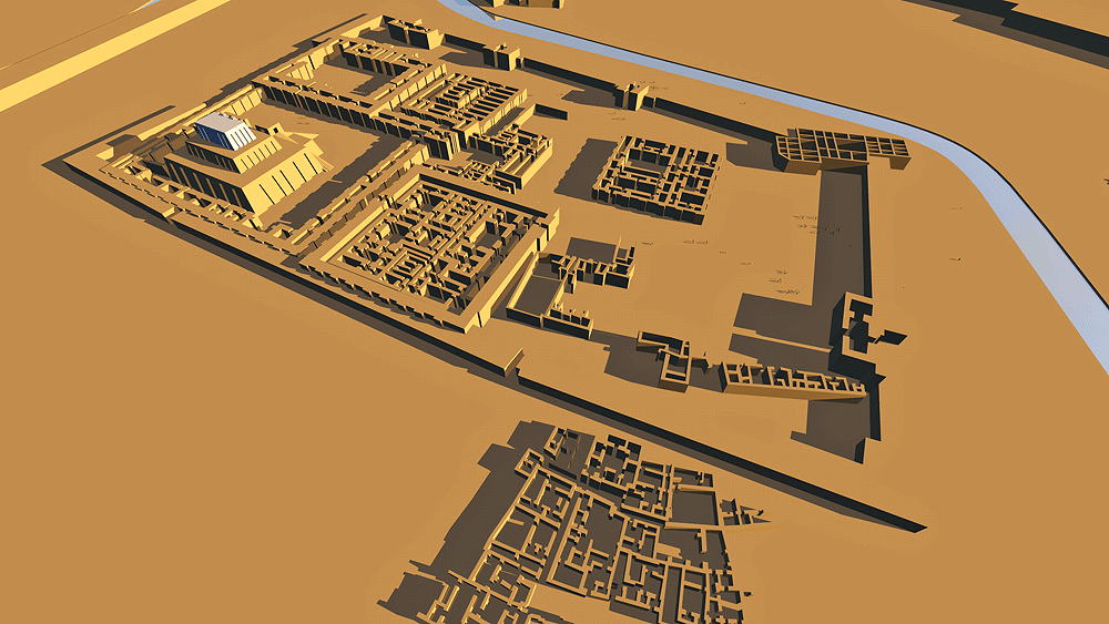
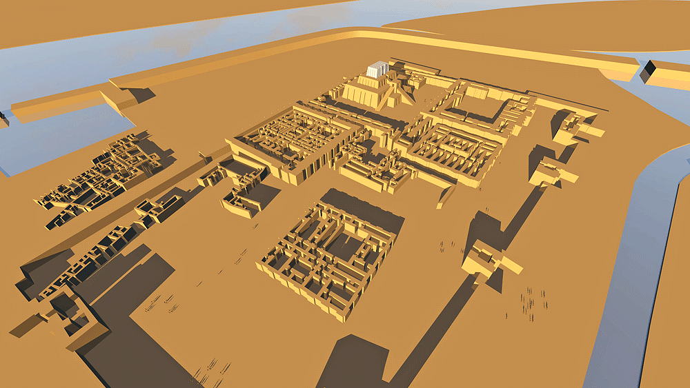
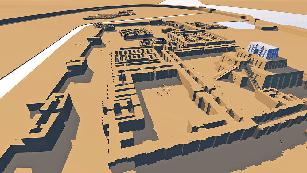
Sumerian and Babylonian Civilization; a Mesopotamian city-state in ancient Mesopotamia, occupation dating from c. 6500 B.C.E.; located at the site of modern Tell el-Muqayyar, Iraq; originally a Persian Gulf coastal city begun c. 3800 B.C.E., near the mouth of the Euphrates and Tigris Rivers before those rivers changed courses. The central rectangular walled Sacred Precinct contains the Ur-Namma Ziggurat (containing the Shrine of the God, the Court of Nanna, the Giparu, and Royal Tombs. Outside the Sacred Precindt walls and within the City walls are high density residential areas and a Palace, the excavated portions of which are shown in the model.
Elevation is 6 meters (19.69 feet) above sea level.
Materials: sun-dried earth (adobe) bricks covered with kiln-fired glased bricks laid in natural occurring bitumen.
Data for this CG model:
1.The New General PLan of Ur (F.Ghio)
https://www.researchgate.net/figure/The-new-general-plan-of-Ur-drawn-up-by-F-Ghio-1-City-Wall-2-North-Harbour-3_fig12_258386554
3. https://www.researchgate.net/publication/258386554_Multitemporal_High-Resolution_Satellite_Images_for_the_Study_and_Monitoring_of_an_Ancient_Mesopotamian_City_and_its_Surrounding_Landscape_The_Case_of_Ur