
Yellowhouse Pueblo (Hecota or "yellow ruin")
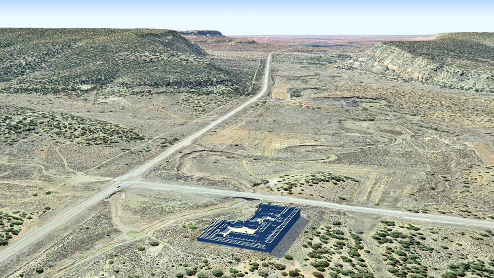
Photomontage of Yellowhouse CG model over aerial photo of actual site at the intersection of Highway 602 and 53, looking west toward the present Zuni Pueblo in the distant horizon..
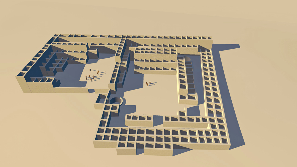
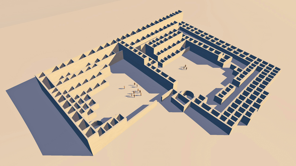
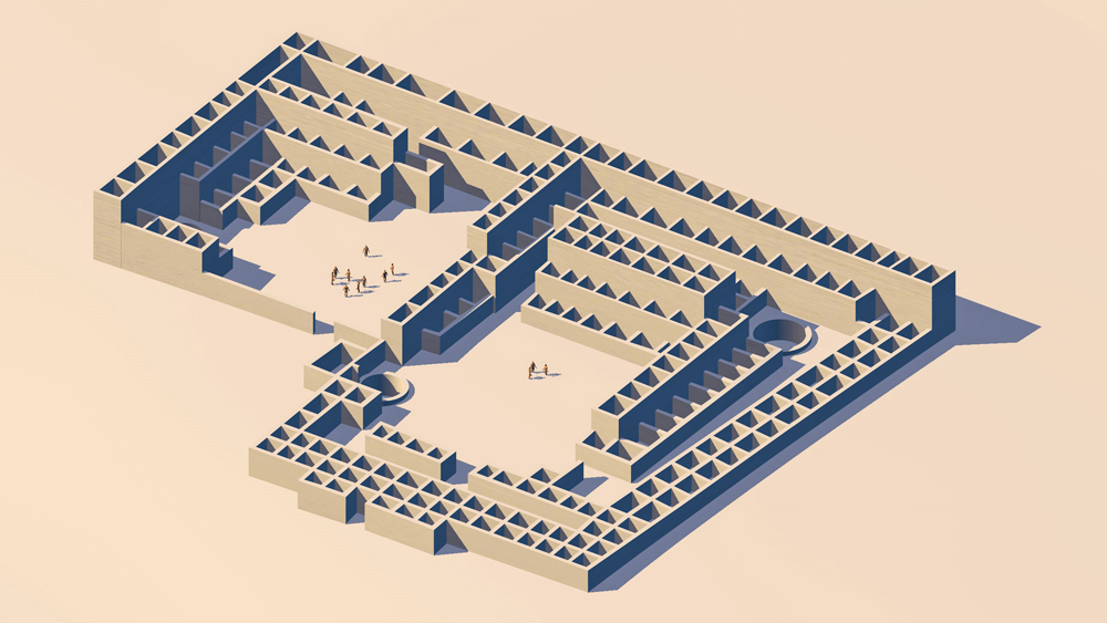
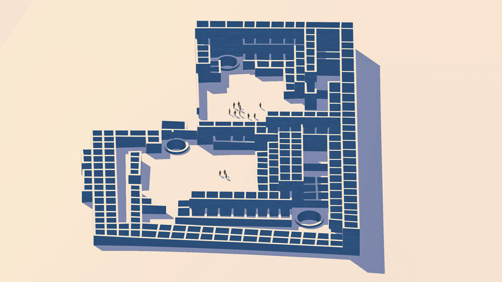
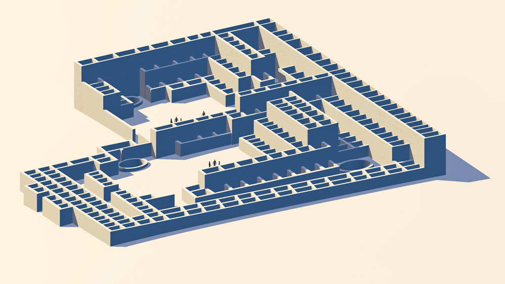
Zuni Ancestral Puebloan Culture, occupied 1275 CE to 1325 CE, located on the Zuni River, Zuni Pueblo, New Mexico. The plan of the Pueblo consists of two adjacent rectangular room blocks, each with its own plaza and kivas. The plan is unique in that the east room block has two "streets" to the east and south of the plaza. Including the secons story rooms the total room count for Yellowhouse is estimated to be 420. Ceramics found at the site helped to establish the date of construction through habitation at 1275 through1325 CE.
Elevation is 2011 meters (6598 feet) abofe sea level.
Materials: walls constructed with mud-mortared sandstone and basalt stone both shaped and unshaped, wood log roof structure, with mud/clay roof.
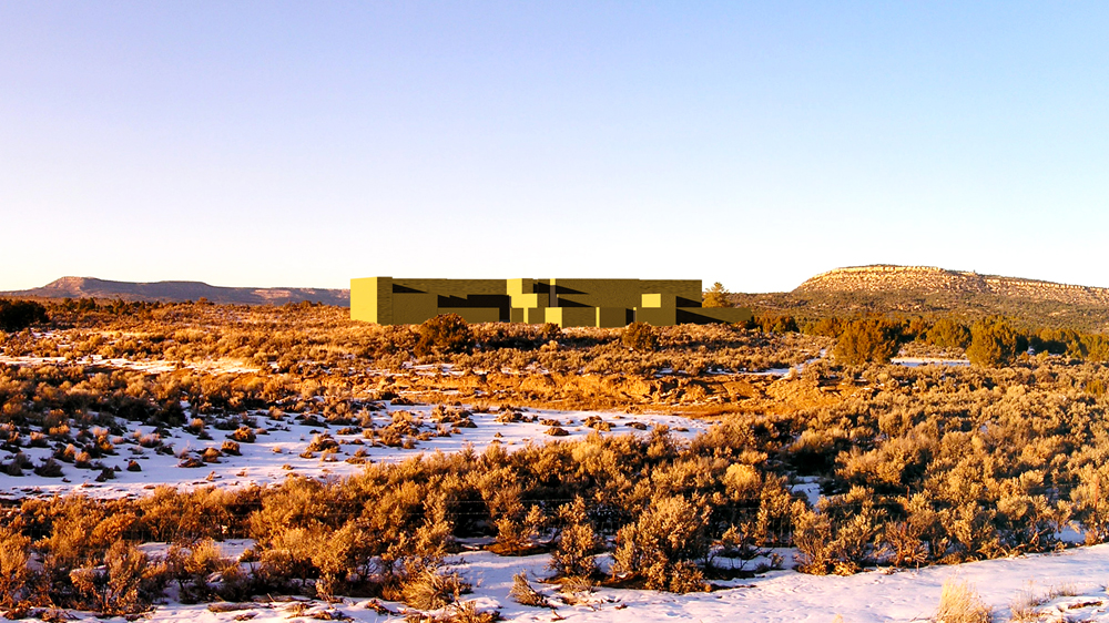
Photomontage of three story CG model on eye-level photo of actual site, by author, looking north.
Looking north.
Looking east.
Looking northeast.
Looking northwest.
Looing west.
Looking northeast.
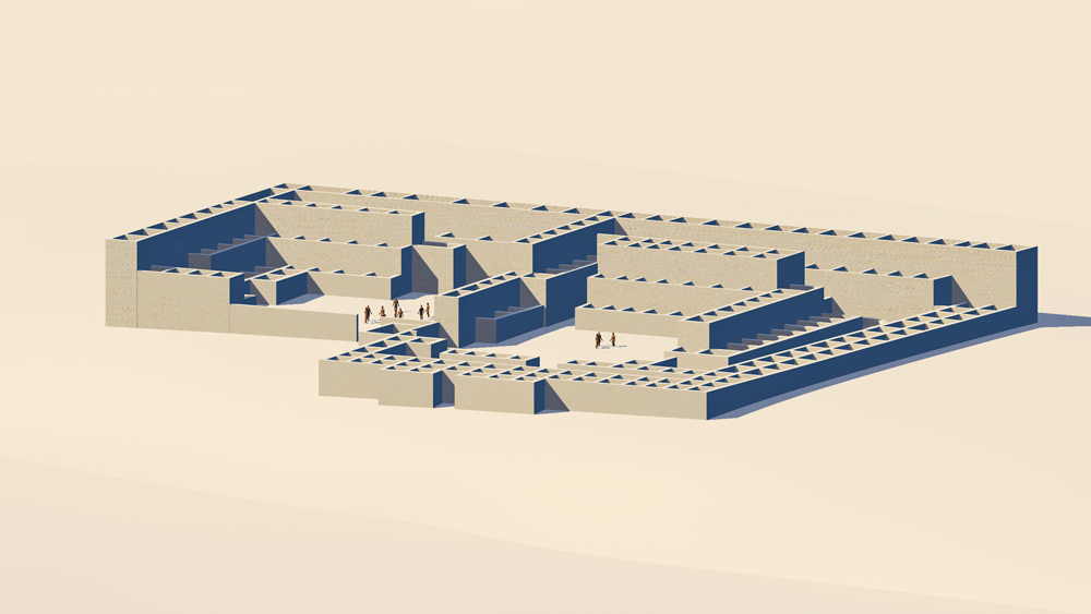
Looking northwest.
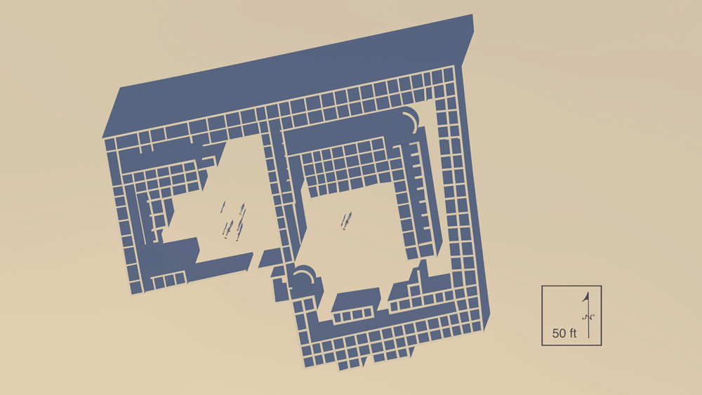
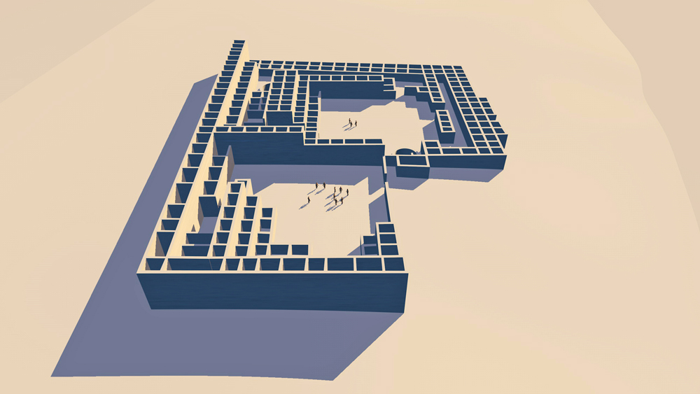
Yellowhouse CG model plan with scale and orientation.
Data for CG model:
1. Morgan, William N., 1994. ANCIENT ARCHITECTURE OF THE SOUTHWEST, University of Texas Press, Austin, Texas.
2. Hunter-Anderson, Rosalind L. 1978. An Archaeological Survey of the Yellowhouse Dam Area. On file at the Office of Contract Archaeology, University of New Mexico, Albuquerque.